MOS: 534
Difficulty: 2 / 4
Duration: 1,5 hours one way
MOS: 534
Difficulty: 2 / 4
Duration: 1,5 hours one way
MAS: 530
Difficulty: 2 / 4
Duration: 2 hours one way
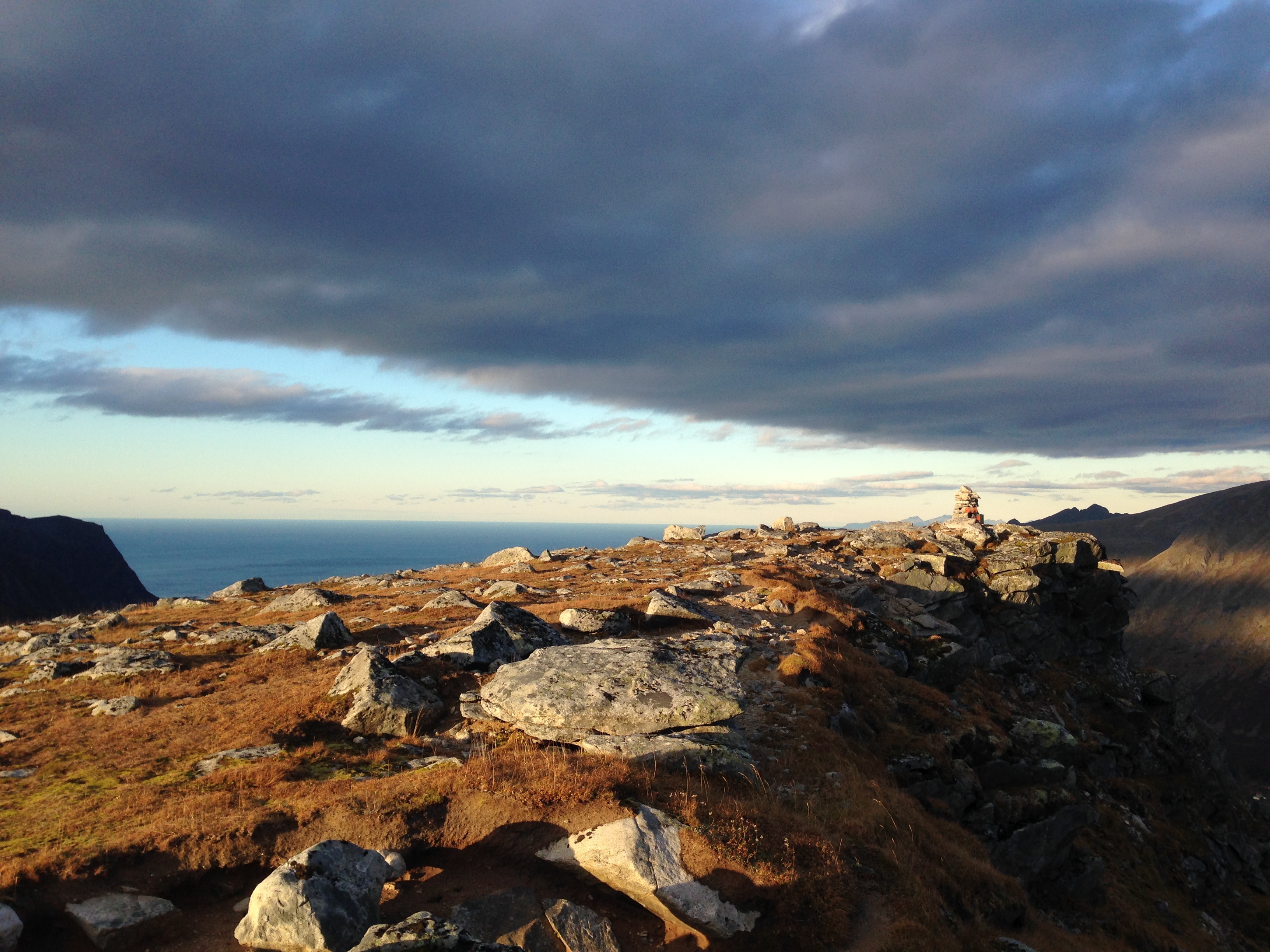
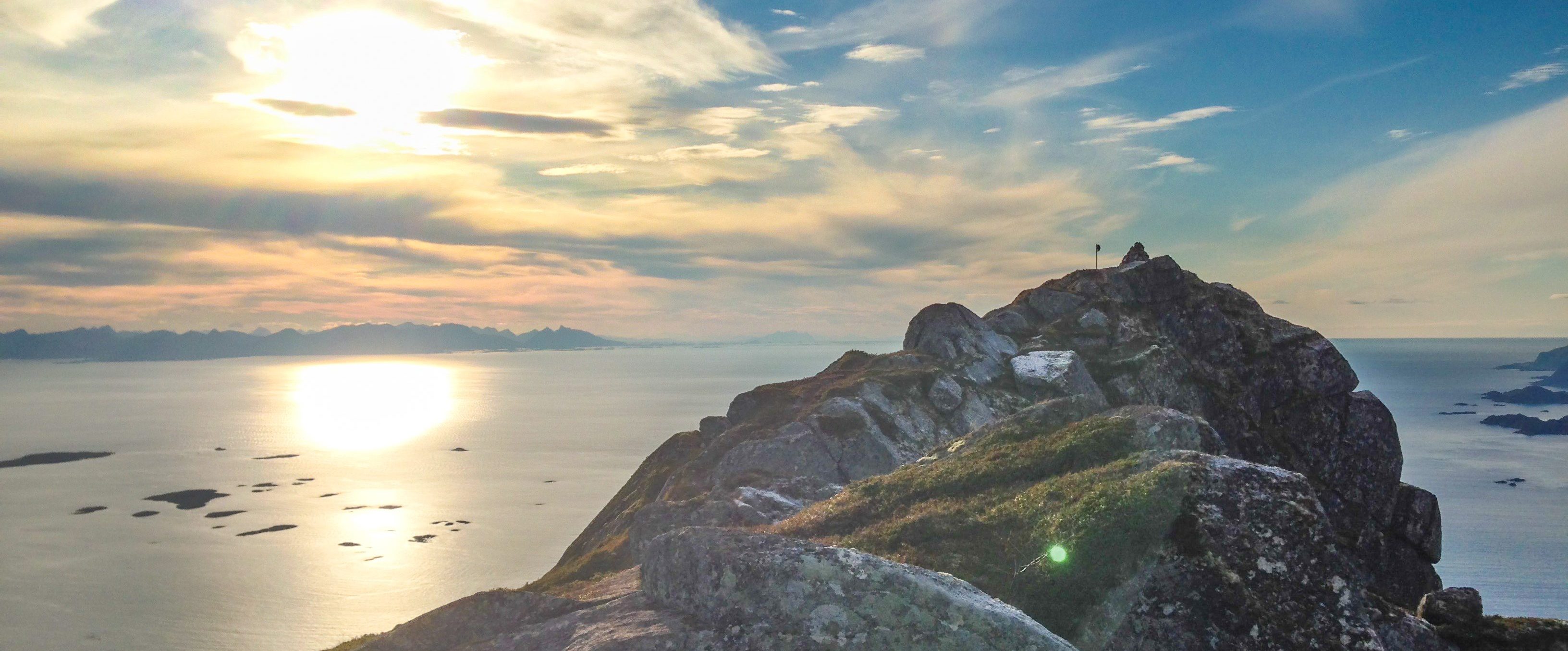
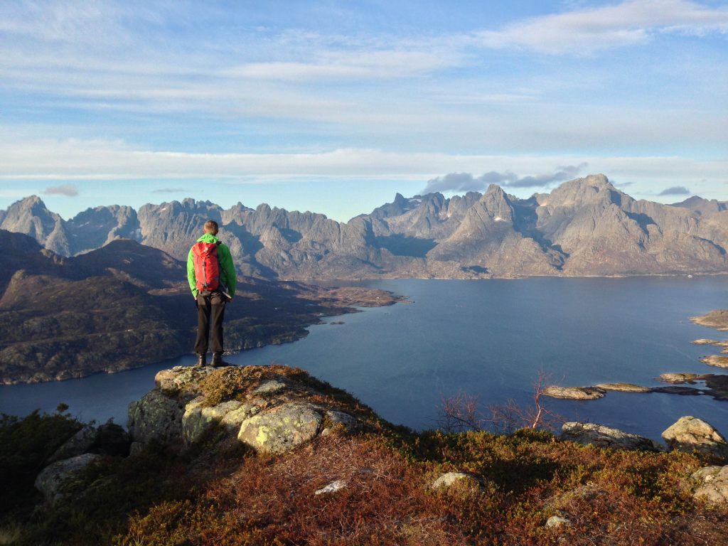
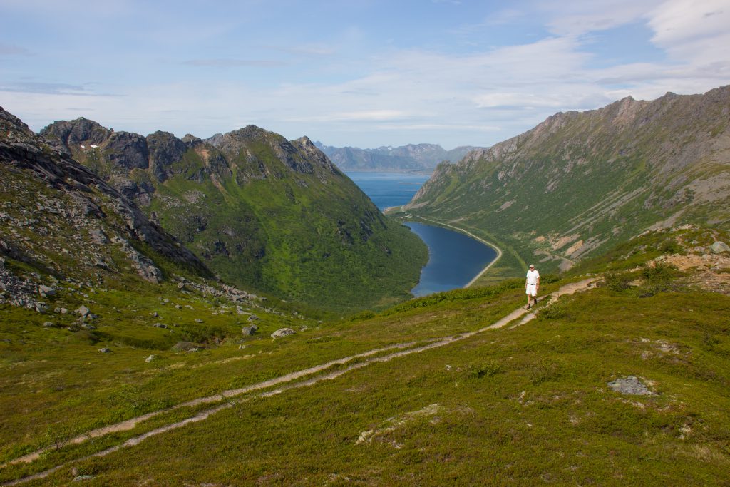
The mountain is located at the sea, which makes the view fantastic in all directions. To the west in Raftsundet, you can spot the highest mountains in the Lofoten islands. To the south and east you can see the Vestfjord and the surrounding mountains and islands. This might be the reason why Her Majesty Queen Sonja of Norway visited this mountain on her trip the northern Norway in 2016.
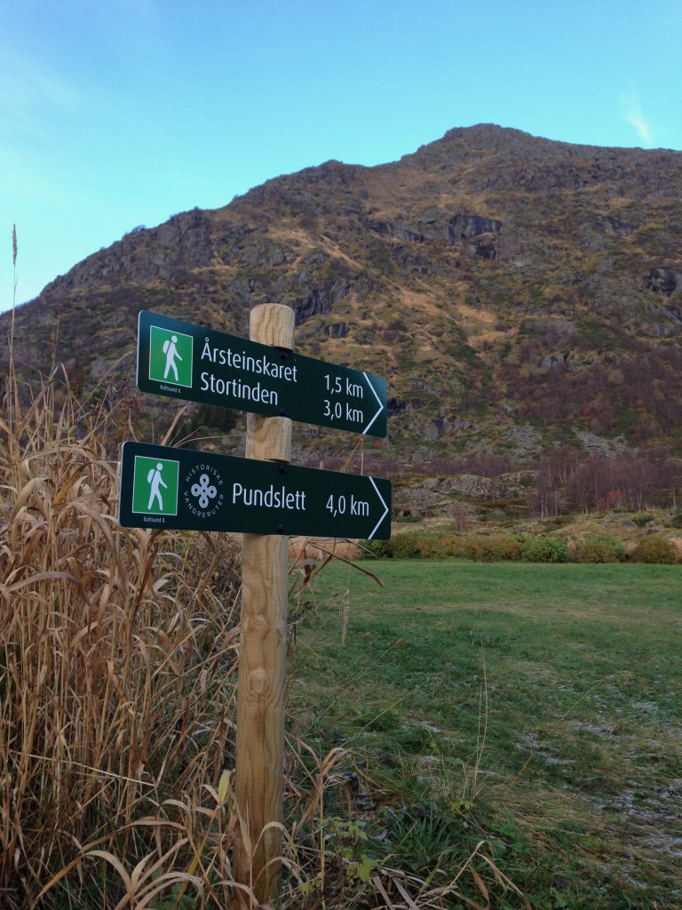
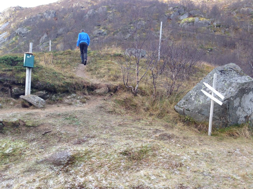
The hike to Stortinden starts at Årstein, south of Digermulen. You can also start hiking at Pundslett. From Årstein, follow the gravel road from the parking. After 300 meters a sign indicates the start of the trail. Follow the trail up the valley. After 1,7 km, follow the trail going west. The trail is marked, and will get steeper as you go on. When you get to the top of the ridge, you can choose to follow the path to Stortinden or its neighbor Lilleårsteintinden. Both trails are marked. From here, follow the trail to the top.
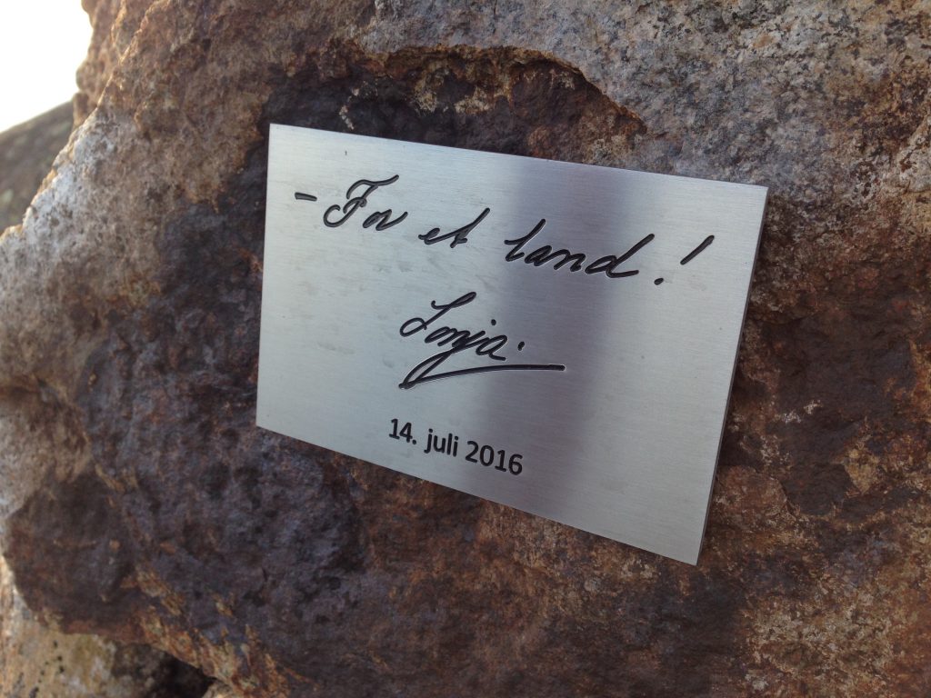
Her Majesty Queen Sonja of Norways signature is waiting at the summit.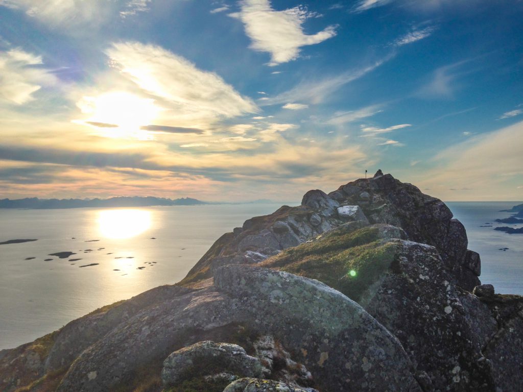

MOS: 541 / 211
Difficulty: 2 / 4
Duration: 2 hours one way
Festvågtinden is located right before Henningsvær and provides fantastic views over Vestfjord and Henningsvær. It will be possible to park in Festvåg, and right before the first bridge going to Henningsvær (see map). The trail begins inside Urvika, right after Festvåg on the way to Henningsvær. In Urvika you will The trail will split early on meaning you must follow the path to he right to get to Nipen and Festvågtinden. The trip to Festvågtinden is somewhat steep. If you want a slightly shorter trip but still with good views you can choose to go to Nipen or take a bath in Heiavatnet.
MOH: 419
Difficulty: 1 / 4
Duration: 1 hour one way
The trip to Glomtind starts by the old national road of Rørvikskaret, before the exit to Henningsvær. You can park at the entrance to the old road on both sides of the rock face to then join the old road. On the rock face there is a clear path in the southeasterly direction following the ridge to the top. The final section to the top is somewhat steep. This walk offers great views.
MOH: 355
Difficulty: 3 / 4
Duration: 1 hour one way
OBS: To get to the very top of the rock formation Svolværgeita you have to climb. It’s recommended to go with a guide, unless you are an experienced climber.
MOH: 590
Difficulty: 3 / 4
Duration: 2 hours one way
The walk up to Svolværgeita, Djevelporten and Fløya is steep but offers great views after only a few minutes walk. The walk starts west of the cemetery, in the bend past the nursery. After about 200 meters the trail splits, where one can choose to go east toward Svolværgeita or continue north towards Djevelporten and Fløya. The trail to the foot of Svolvægeita is steep with loose gravel and sand, and can be somewhat challenging. The path to Djevelporten and Fløya continues up the valley, where you will first get to Djevelporten and then to Fløya. Some sections around Djevelporten and Fløya are steep and can be windy.
MOH: 367
Difficulty: 1 / 4
Duration: 1 hour one way
Tjeldbergtind is a great and easy walk which gives good views of the Vestfjord, Svolvaer and Kabelvåg. Follow E10 west from Svolær for about 2 km, and turn off at the Esso petrol station. The walk starts at the second driveway on the left. The road will quickly change surface from asphalt to gravel. Follow the road, which eventually passes a firing range. In the last turn before the radio mast at the large rock on the west side, the trail to the summit of the mountain starts. Follow the path up the hillside. When you get to the back of the mountain, you can choose to go to the southern or northern peak. The southern top provides good views of the west bay. The northern peak is somewhat higher and is somewhat steeper to get up to, but is also a great vantage point.
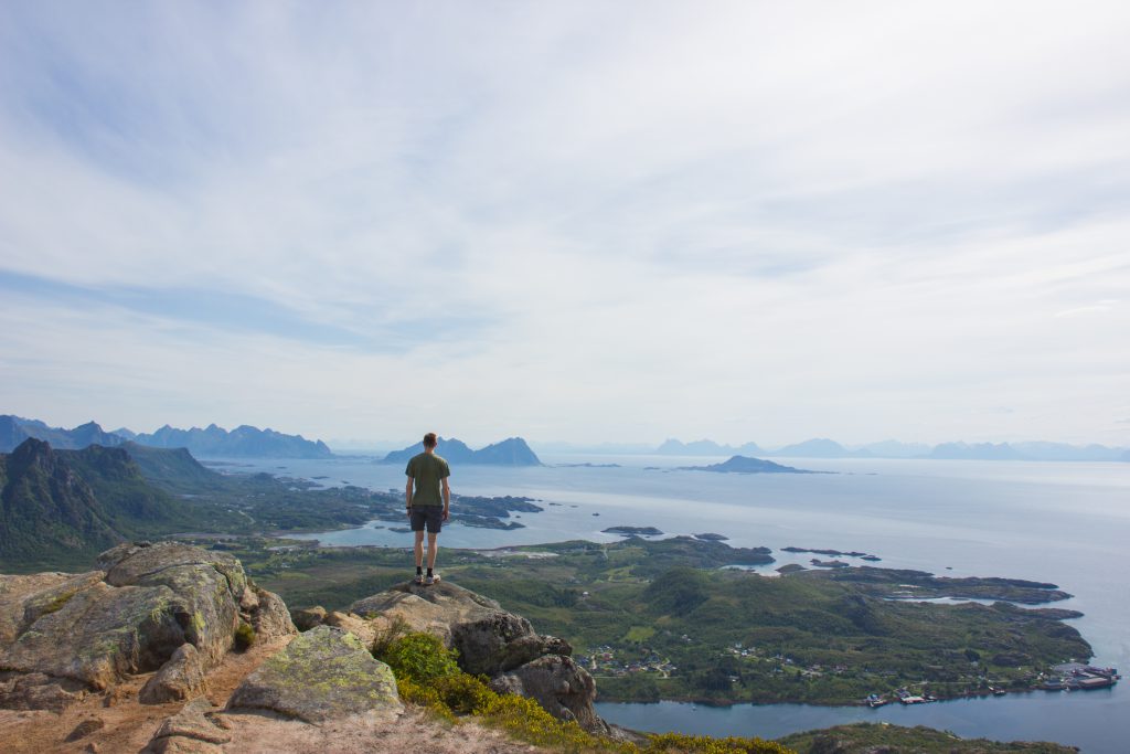
Svolvær is the biggest town in Lofoten with 4500 residents and the base for many tourists visiting Lofoten. Svolvær offers a great variety of accommodations, restaurants and hikes. Surrounded by mountains on the east, north and west side of the town Svolvær is the base for many great hikes and viewpoints.

Tjeldbergtind is a easy and short hike with great views, close to the road. This makes this mountain very popular among locals and tourists. Read more…
2. Geita / Djevelporten / Fløya
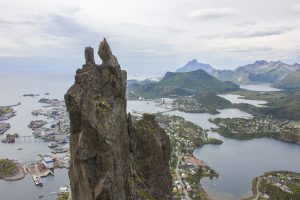
Hiking towards Geita, Djevelporten or Fløya offers great views. The hike is some steep and some parts are windy. Read more…

Tuva is a great viewpoint. On the way you will walk side by side with rivers and lakes. The path is well trodden. Read more…
MOH: 477
Difficulty: 2 / 4
Duration: 2 hours one way
The trail to Tuva starts near the campsite Lofoten Feriesenter and the Red Cross house. Here it is possible to park (see parking on the map under). From the parking, follow the gravel road going north, which will turn in to a path. Follow the path in the direction of Grønnåsen, and walk on the side of the lake. After the lake, follow the path side by side the river towards the top. The last part going to the top is windy, but offers great views.
MOH: 368
Difficulty: 1 / 4
Duration: 1 hour one way
Hoven is a great trip to combine with the midnight sun. It is also a good vantage point
with views to Austvågøy and Vestvågøy. The walk starts at the golf course parking
lot, firstly going over flat marsh before going up the back of the mountain. The path is
well trodden and is easy to find.